
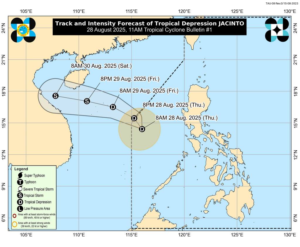
The low pressure area west of Subic Bay has intensified into Tropical Depression “Jacinto,” according to the Philippine Atmospheric Geophysical and Astronomical Services Administration (PAGASA).
In its 11 a.m. bulletin, the weather bureau said Jacinto was last tracked 480 km. west of Subic Bay with maximum sustained winds of 45 km. per hour (kph), gustiness of up to 55 kph. It is moving west-northwestward at 20 kph.
No Tropical Cyclone Wind Signals (TCWS) are currently in effect.
While Jacinto is not expected to directly hit land, it is enhancing the southwest monsoon, which will bring occasional heavy rains and strong to gale-force gusts over the following areas:
- Aug. 28 to 29: Batanes, Babuyan Islands, Ilocos Region, Cordillera Administrative Region, Zambales, Bataan, Mimaropa, Western Visayas, Negros Island Region, Central Visayas, Dinagat Islands, and Camiguin.
- Aug. 30: Batanes, Babuyan Islands, Pangasinan, Zambales, Lubang Island, Romblon, and Palawan.
PAGASA advised residents in affected areas to remain alert against possible flooding and landslides, especially in communities highly susceptible to rain-induced hazards.
No gale warning is currently in effect, but rough seas up to 3.5 meters are expected over the northern and western seaboards of Calamian Islands and northern Palawan.
Moderate to rough seas will prevail in other western seaboards, particularly along Zambales, Pangasinan, Occidental Mindoro, and parts of the Visayas.
Small seacraft operators, especially motorbancas, are strongly discouraged from venturing out to sea under these conditions.
Jacinto is expected to move northwestward and exit the Philippine Area of Responsibility (PAR) tonight, heading toward the West Philippine Sea.
It may strengthen into a tropical storm by Friday evening before making landfall in northern or central Vietnam by Saturday. (PNA)
📸Courtesy of DOST-PAGASA

Leave a comment