
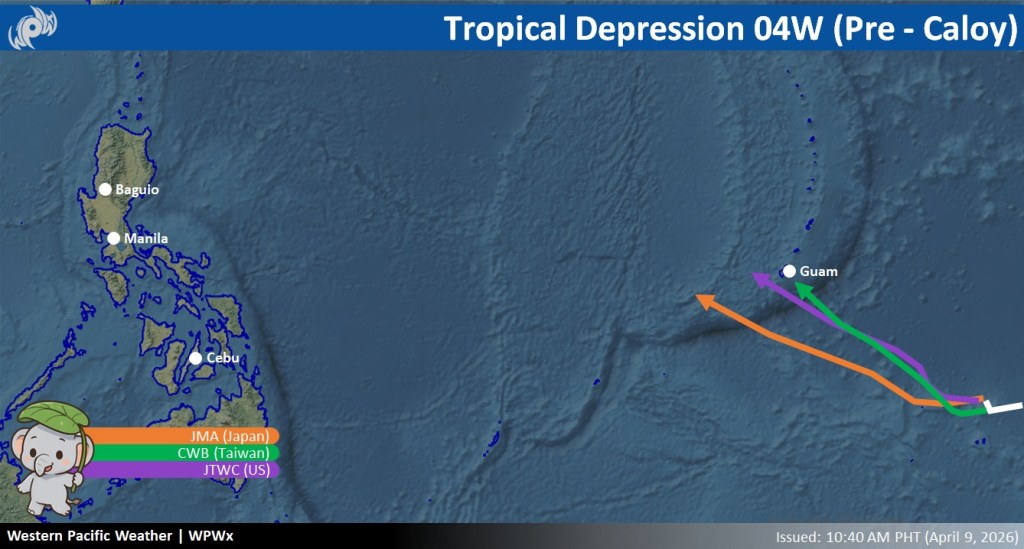
Authorities are closely monitoring a developing tropical storm over the Western Pacific Ocean that is expected to intensify into a typhoon within the next few days, according to various weather agencies.
Forecast models from the Joint Typhoon Warning Center (JTWC) and Taiwan’s Central Weather Administration (CWA) indicate that the weather disturbance may pass very close to Guam, prompting residents in the area to remain vigilant and closely monitor updates. Meanwhile, the Japan Meteorological Agency (JMA) places the storm on a more southerly track.
While the storm remains far from the Philippines, weather observers are advising the public to stay alert as there is a strong possibility that the system may enter the Philippine Area of Responsibility (PAR) in the coming days.
Should the storm enter PAR, it will be assigned the local name “Caloy.”
Authorities emphasized that no definite forecast has been issued yet regarding the storm’s potential impact on the Philippines due to its current distance and evolving track.
Residents are urged to continue monitoring official weather bulletins and advisories for updates on the storm’s movement and intensity.
📸 Westernpacificweather.com

Leave a comment